Title:
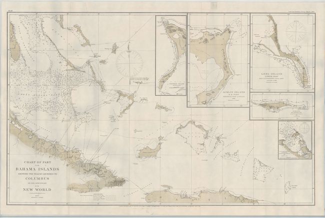
“Chart of Part of the Bahama Islands Showing the Tracks Ascribed to Columbus on His Discovery of the New World”
Map Maker:
U.S. Coast & Geodetic Survey
This large format chart shows the tracks of Columb... (full text available to subscribers)
| Item Detail |
| |
| |
MapMaker: |
U.S. Coast & Geodetic Survey
|
|
| |
| |
Subject: |
Caribbean, Bahamas |
|
| |
Period/Size: |
1881 / 22.3" x 35.3" (56.7 x 89.7 cm)
|
|
| |
Color: |
Colored
|
|
| |
Condition: |
(B+) Professionally backed with thick blue paper to reinforce and repair a few minor edge tears and chips. A binding trim at left has been professionally replaced to accommodate framing. (condition help) |
|
| |
Source: |
|
|
| |
References: |
|
|
| |
|
|
| Sales Information |
| |
| |
Price: |
|
|
| |
| |
Offered by: |
Old World Auctions |
|
| |
Catalog: |
Auction No. 145 - Antique Maps, Charts, Atlases & Globes (9224) |
|
| |
Lot/Item #: |
347 |
|
| |
| |
Date: |
06/2013
|
|
| |
| |
|
Antique Maps - Valuation and Pricing, Descriptions, Resources |
|
Home |
Information |
Search |
Register |
Contact Us |
Site Map
Americana Exchange, Inc. © 1999 - 2024 Americana Exchange, Inc.. All rights reserved.
OldMaps.com, the OldMaps.com logo and
AMPR are service marks or registered service marks of Americana Exchange, Inc..
|