Title:
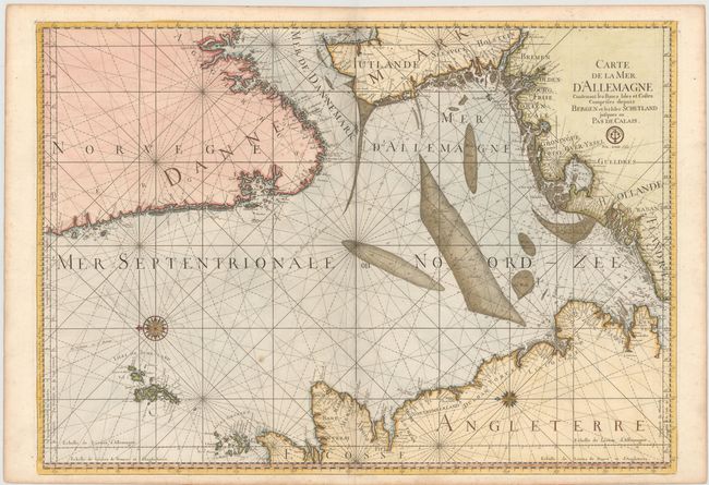
“Carte de la Mer d'Allemagne Contenant les Bancs Isles et Costes Comprises Depuis Bergen et les Isles Schetland Jusques au Pas de Calais”
Map Maker:
Jacques Nicolas Bellin
Fine, large sea chart of the North Sea and Skagerr... (full text available to subscribers)
| Item Detail |
| |
| |
MapMaker: |
Jacques Nicolas Bellin
|
|
| |
| |
Subject: |
North Sea |
|
| |
Period/Size: |
1773 / 24.1" x 33.9" (61.3 x 86.1 cm)
|
|
| |
Color: |
Colored
|
|
| |
Condition: |
(B+) A fine impression and attractive color on heavy, watermarked paper with light soiling and a couple of tiny worm tracks adjacent to centerfold at bottom of map. (condition help) |
|
| |
Source: |
La Neptune Francois… |
|
| |
References: |
Pastoureau, NEPTUNE FRANCAIS D #5. |
|
| |
|
|
| Sales Information |
| |
| |
Price: |
|
|
| |
| |
Offered by: |
Old World Auctions |
|
| |
Catalog: |
Auction No. 145 - Antique Maps, Charts, Atlases & Globes (9224) |
|
| |
Lot/Item #: |
468 |
|
| |
| |
Date: |
06/2013
|
|
| |
| |
|
Antique Maps - Valuation and Pricing, Descriptions, Resources |
|
Home |
Information |
Search |
Register |
Contact Us |
Site Map
Americana Exchange, Inc. © 1999 - 2024 Americana Exchange, Inc.. All rights reserved.
OldMaps.com, the OldMaps.com logo and
AMPR are service marks or registered service marks of Americana Exchange, Inc..
|