| Item Detail |
| |
| |
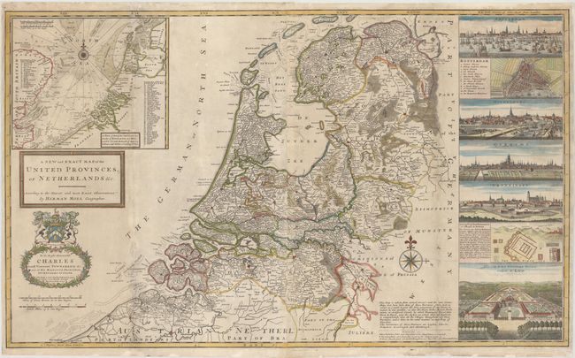
MapMaker: |
Herman Moll
|
|
| |
| |
Subject: |
Netherlands |
|
| |
Period/Size: |
1750 / 24.3" x 40.1" (61.8 x 101.9 cm)
|
|
| |
Color: |
Colored
|
|
| |
Condition: |
(B) Issued folding, with light soiling, one small abrasion south of Breda, and some printer's ink residue at top left. The map appears to have been completely separated along the vertical folds at right and left with several small holes along folds at to (condition help) |
|
| |
Source: |
Athlas [sic] Royal |
|
| |
References: |
Shirley (BL Atlases) T.MOLL-4c #25. |
|
| |
|
|
| Sales Information |
| |
| |
Price: |
|
|
| |
| |
Offered by: |
Old World Auctions |
|
| |
Catalog: |
Auction No. 145 - Antique Maps, Charts, Atlases & Globes (9224) |
|
| |
Lot/Item #: |
484 |
|
| |
| |
Date: |
06/2013
|
|
| |
| |
|