| Item Detail |
| |
| |
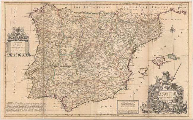
MapMaker: |
Herman Moll
|
|
| |
| |
Subject: |
Spain & Portugal |
|
| |
Period/Size: |
1711 / 23.8" x 38.3" (60.5 x 97.3 cm)
|
|
| |
Color: |
Colored
|
|
| |
Condition: |
(B) Issued folding with original outline color, minor offsetting, a few tiny wormholes only visible when held to light, and toning along the folds. The left and right folds are backed with tissue to reinforce and repair numerous long separations. (condition help) |
|
| |
Source: |
The World Described |
|
| |
References: |
Shirley (BL Atlases) T.MOLL-4b [24]. |
|
| |
|
|
| Sales Information |
| |
| |
Price: |
|
|
| |
| |
Offered by: |
Old World Auctions |
|
| |
Catalog: |
Auction No. 145 - Antique Maps, Charts, Atlases & Globes (9224) |
|
| |
Lot/Item #: |
521 |
|
| |
| |
Date: |
06/2013
|
|
| |
| |
|