| Item Detail |
| |
| |
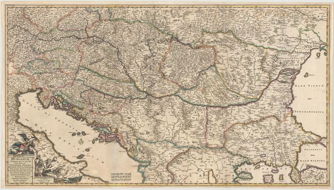
MapMaker: |
Frederick de Wit
|
|
| |
| |
Subject: |
Southern Europe |
|
| |
Period/Size: |
1688 / 19.7" x 34.9" (50.1 x 88.7 cm)
|
|
| |
Color: |
Colored
|
|
| |
Condition: |
(B) A fine impression with original outline color, light soiling, professional repairs to several fold separations, and a long vertical printer's crease at right. There are faint damp stains at top right, and the left margin has been extended to accommod (condition help) |
|
| |
Source: |
|
|
| |
References: |
|
|
| |
|
|
| Sales Information |
| |
| |
Price: |
|
|
| |
| |
Offered by: |
Old World Auctions |
|
| |
Catalog: |
Auction No. 145 - Antique Maps, Charts, Atlases & Globes (9224) |
|
| |
Lot/Item #: |
587 |
|
| |
| |
Date: |
06/2013
|
|
| |
| |
|