Title:
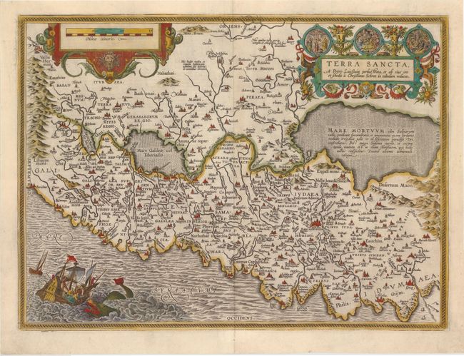
“Terra Sancta, a Petro Laicstain Perlustrata, et ab eius ore et Schedis a Christiano Schrot in Tabulam Redacta”
Map Maker:
Abraham Ortelius
This striking map is considered the most 'modern' ... (full text available to subscribers)
| Item Detail |
| |
| |
MapMaker: |
Abraham Ortelius
|
|
| |
| |
Subject: |
Holy Land |
|
| |
Period/Size: |
1603 / 14.5" x 19.7" (36.9 x 50.1 cm)
|
|
| |
Color: |
Colored
|
|
| |
Condition: |
(A) Lovely color on watermarked paper. There are a few tiny tears and chips in blank margins that have been professionally repaired. There is slight weakness along the plate mark at top left that has been reinforced on verso with Japanese tissue. (condition help) |
|
| |
Source: |
Theatrum Orbis Terrarum |
|
| |
References: |
Laor #543; Nebenzahl (HL) plt. 31; Van den Broecke #173. |
|
| |
|
|
| Sales Information |
| |
| |
Price: |
|
|
| |
| |
Offered by: |
Old World Auctions |
|
| |
Catalog: |
Auction No. 145 - Antique Maps, Charts, Atlases & Globes (9224) |
|
| |
Lot/Item #: |
669 |
|
| |
| |
Date: |
06/2013
|
|
| |
| |
|
Antique Maps - Valuation and Pricing, Descriptions, Resources |
|
Home |
Information |
Search |
Register |
Contact Us |
Site Map
Americana Exchange, Inc. © 1999 - 2024 Americana Exchange, Inc.. All rights reserved.
OldMaps.com, the OldMaps.com logo and
AMPR are service marks or registered service marks of Americana Exchange, Inc..
|