Title:
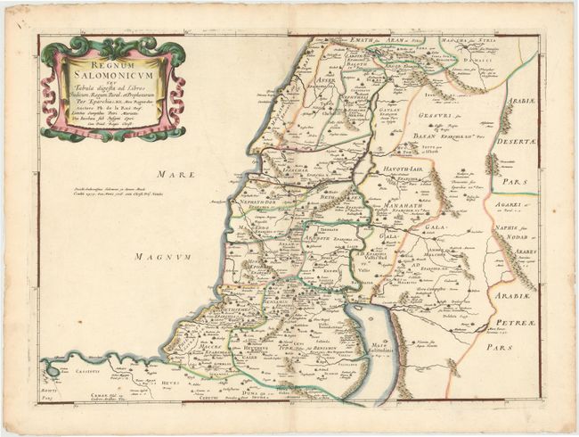
“Regnum Salomonicum seu Tabula Digesta ad Libros Judicum, Regum, Paral, et Prophetarum per Eparchias, XII, Mox Regna duo”
Map Maker:
Philippe De La Rue
Very handsome map of the Holy Land during the reig... (full text available to subscribers)
| Item Detail |
| |
| |
MapMaker: |
Philippe De La Rue
|
|
| |
| |
Subject: |
Holy Land |
|
| |
Period/Size: |
1651 / 15.6" x 21.4" (39.7 x 54.4 cm)
|
|
| |
Color: |
Colored
|
|
| |
Condition: |
(A) Watermarked paper with one minute worm hole, a few tiny spots, and a hint of toning along centerfold. (condition help) |
|
| |
Source: |
La Terre Sainte en Six Cartes Geographiquesģ |
|
| |
References: |
Laor #417; Pastoureau, LA RUE [3]. |
|
| |
|
|
| Sales Information |
| |
| |
Price: |
|
|
| |
| |
Offered by: |
Old World Auctions |
|
| |
Catalog: |
Auction No. 145 - Antique Maps, Charts, Atlases & Globes (9224) |
|
| |
Lot/Item #: |
672 |
|
| |
| |
Date: |
06/2013
|
|
| |
| |
|
Antique Maps - Valuation and Pricing, Descriptions, Resources |
|
Home |
Information |
Search |
Register |
Contact Us |
Site Map
Americana Exchange, Inc. © 1999 - 2024 Americana Exchange, Inc.. All rights reserved.
OldMaps.com, the OldMaps.com logo and
AMPR are service marks or registered service marks of Americana Exchange, Inc..
|