Title:
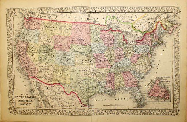
“Mitchell's New General Atlas, Containing Maps of the Various Counties of the World, Plans of Cities, Etc…”
Map Maker:
Samuel Augustus Mitchell
This is a great example of Mitchell's atlas that i... (full text available to subscribers)
| Item Detail |
| |
| |
MapMaker: |
Samuel Augustus Mitchell
|
|
| |
| |
Subject: |
Atlases |
|
| |
Period/Size: |
1867 / 15.5" x 13.0" (39.4 x 33.1 cm)
|
|
| |
Color: |
Colored
|
|
| |
Condition: |
(B) The binding is perished and should be considered a collection of loose sheets. The maps are generally in good to near fine condition, with some isolated foxing, minor spots, edge tears and edge chips. The map of New York has a bottom centerfold sepa (condition help) |
|
| |
Source: |
|
|
| |
References: |
|
|
| |
|
|
| Sales Information |
| |
| |
Price: |
|
|
| |
| |
Offered by: |
Old World Auctions |
|
| |
Catalog: |
Auction No. 145 - Antique Maps, Charts, Atlases & Globes (9224) |
|
| |
Lot/Item #: |
850 |
|
| |
| |
Date: |
06/2013
|
|
| |
| |
|
Antique Maps - Valuation and Pricing, Descriptions, Resources |
|
Home |
Information |
Search |
Register |
Contact Us |
Site Map
Americana Exchange, Inc. © 1999 - 2024 Americana Exchange, Inc.. All rights reserved.
OldMaps.com, the OldMaps.com logo and
AMPR are service marks or registered service marks of Americana Exchange, Inc..
|