Title:
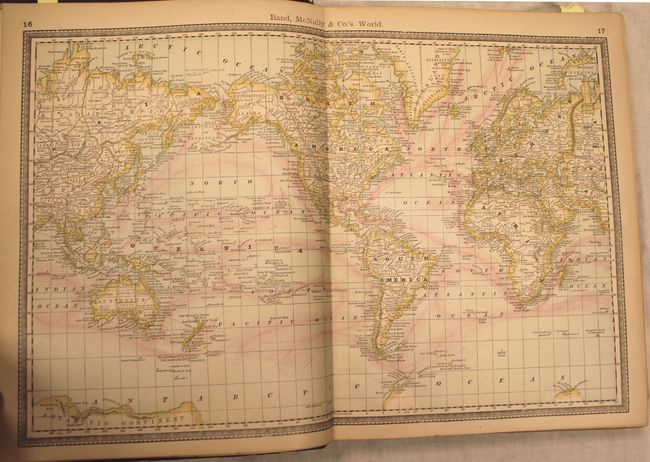
“Rand, McNally & Co.'s Improved Indexed Business Atlas and Shippers' Guide. Containing Large Scale Maps of the Dominion of Canada, Old Mexico, Central America, Cuba, and the Several States and Territories of the United States...”
Map Maker:
Rand, McNally & Co.
This complete atlas is much sought after for its g... (full text available to subscribers)
| Item Detail |
| |
| |
MapMaker: |
Rand, McNally & Co.
|
|
| |
| |
Subject: |
Atlases |
|
| |
Period/Size: |
1888 / 14.5" x 11.5" (36.9 x 29.3 cm)
|
|
| |
Color: |
Colored
|
|
| |
Condition: |
(B+) Maps are fine to very good with some light even-age toning. Contents are tight, the hinges are starting, and both the covers and spine are worn and bumped. (condition help) |
|
| |
Source: |
|
|
| |
References: |
|
|
| |
|
|
| Sales Information |
| |
| |
Price: |
|
|
| |
| |
Offered by: |
Old World Auctions |
|
| |
Catalog: |
Auction No. 145 - Antique Maps, Charts, Atlases & Globes (9224) |
|
| |
Lot/Item #: |
854 |
|
| |
| |
Date: |
06/2013
|
|
| |
| |
|
Antique Maps - Valuation and Pricing, Descriptions, Resources |
|
Home |
Information |
Search |
Register |
Contact Us |
Site Map
Americana Exchange, Inc. © 1999 - 2024 Americana Exchange, Inc.. All rights reserved.
OldMaps.com, the OldMaps.com logo and
AMPR are service marks or registered service marks of Americana Exchange, Inc..
|