| Item Detail |
| |
| |
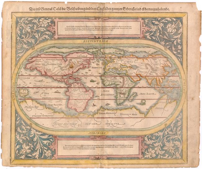
MapMaker: |
Munster/Petri
|
|
| |
| |
Subject: |
World |
|
| |
Period/Size: |
1590 / 12.2" x 14.2" (31.0 x 36.1 cm)
|
|
| |
Color: |
Colored
|
|
| |
Condition: |
(C+) There is some soiling, light toning along centerfold, and two printer's creases at bottom. There are two tears that enter 1" into image that have both been closed on verso with archival tape. The sheet edges are a bit brittle. (condition help) |
|
| |
Source: |
Cosmographia |
|
| |
References: |
Shirley #163. |
|
| |
|
|
| Sales Information |
| |
| |
Price: |
|
|
| |
| |
Offered by: |
Old World Auctions |
|
| |
Catalog: |
Auction No. 146 - Antique Maps, Charts, Atlases & Globes (9225) |
|
| |
Lot/Item #: |
17 |
|
| |
| |
Date: |
09/2013
|
|
| |
| |
|