Title:
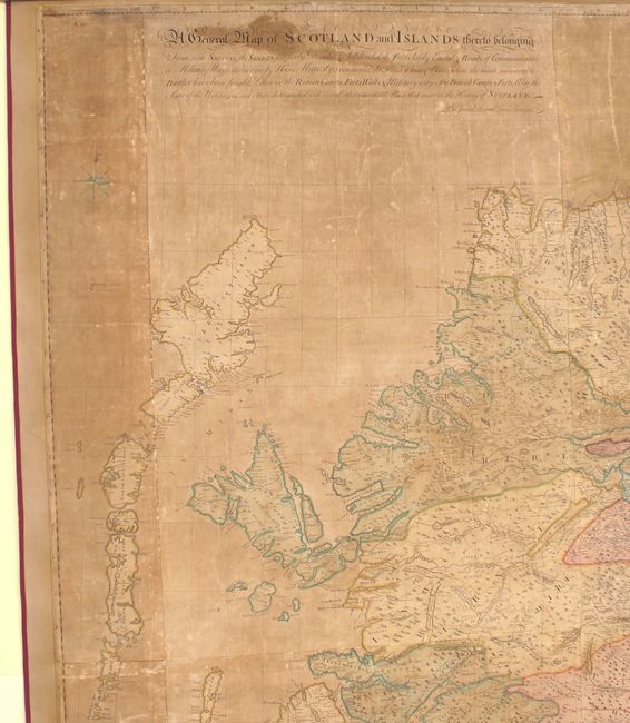
“A General Map of Scotland and Islands Thereto Belonging from New Surveys, the Shires Properly Divided & Subdivided, the Forts Lately Erected & Roads of Communication or Military Ways Carried on by His Majesty's Command...”
Map Maker:
James Dorret
Produced by James Dorret, this is a landmark map o... (full text available to subscribers)
| Item Detail |
| |
| |
MapMaker: |
James Dorret
|
|
| |
| |
Subject: |
Scotland |
|
| |
Period/Size: |
1750 / 69.5" x 52.4" (176.6 x 133.1 cm)
|
|
| |
Color: |
Colored
|
|
| |
Condition: |
(C) Original color. The map is heavily toned with numerous creases in the image, a few short tears, and several small damp stains. Remargined an all sides with parts of border professionally replaced in facsimile. Backed with modern linen with ribbon a (condition help) |
|
| |
Source: |
|
|
| |
References: |
Moir, p. 188. |
|
| |
|
|
| Sales Information |
| |
| |
Price: |
|
|
| |
| |
Offered by: |
Old World Auctions |
|
| |
Catalog: |
Auction No. 146 - Antique Maps, Charts, Atlases & Globes (9225) |
|
| |
Lot/Item #: |
423 |
|
| |
| |
Date: |
09/2013
|
|
| |
| |
|
Antique Maps - Valuation and Pricing, Descriptions, Resources |
|
Home |
Information |
Search |
Register |
Contact Us |
Site Map
Americana Exchange, Inc. © 1999 - 2024 Americana Exchange, Inc.. All rights reserved.
OldMaps.com, the OldMaps.com logo and
AMPR are service marks or registered service marks of Americana Exchange, Inc..
|