Title:
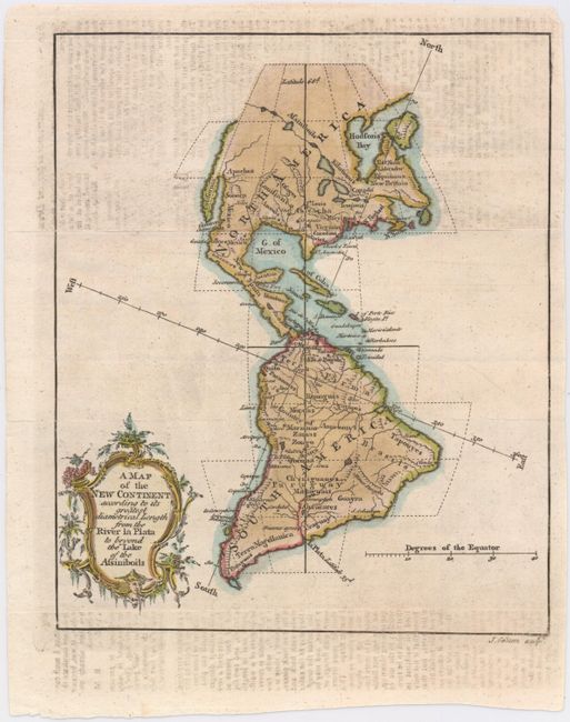
“A Map of the New Continent According to its Greatest Diametrical Length from the River la Plata to beyond the Lake of the Assiniboils”
Map Maker:
John Gibson
This map presents a very interesting, if somewhat ... (full text available to subscribers)
| Item Detail |
| |
| |
MapMaker: |
John Gibson
|
|
| |
| |
Subject: |
Western Hemisphere - America |
|
| |
Period/Size: |
1758 / 8.3" x 7.0" (21.1 x 17.8 cm)
|
|
| |
Color: |
Colored
|
|
| |
Condition: |
(B) Issued folding with some light text transfer. (condition help) |
|
| |
Source: |
Gentleman's Magazine |
|
| |
References: |
Jolly #GENT-122. |
|
| |
|
|
| Sales Information |
| |
| |
Price: |
|
|
| |
| |
Offered by: |
Old World Auctions |
|
| |
Catalog: |
Auction No. 146 - Antique Maps, Charts, Atlases & Globes (9225) |
|
| |
Lot/Item #: |
89 |
|
| |
| |
Date: |
09/2013
|
|
| |
| |
|
Antique Maps - Valuation and Pricing, Descriptions, Resources |
|
Home |
Information |
Search |
Register |
Contact Us |
Site Map
Americana Exchange, Inc. © 1999 - 2024 Americana Exchange, Inc.. All rights reserved.
OldMaps.com, the OldMaps.com logo and
AMPR are service marks or registered service marks of Americana Exchange, Inc..
|