| Item Detail |
| |
| |
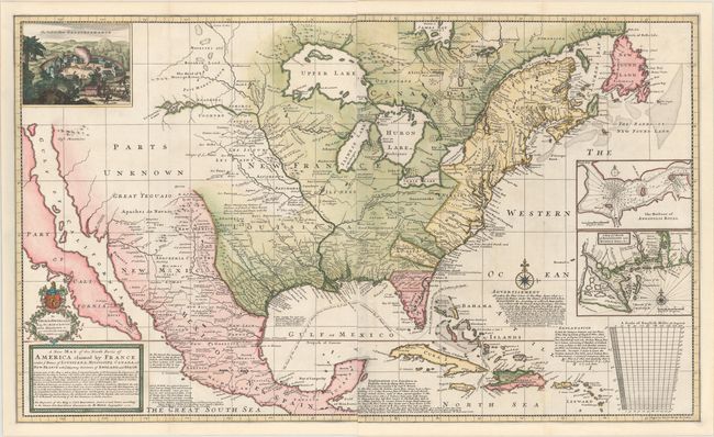
MapMaker: |
Herman Moll
|
|
| |
| |
Subject: |
North America |
|
| |
Period/Size: |
1720 / 24.3" x 39.8" (61.8 x 101.1 cm)
|
|
| |
Color: |
Colored
|
|
| |
Condition: |
(A) A fine impression with very minor soiling, a few professionally repaired fold separations, and a bit of show-through (along Mississippi River) of manuscript notation on verso. Professionally remargined with neatline expertly replaced in facsimile. B (condition help) |
|
| |
Source: |
|
|
| |
References: |
McLaughlin #197; Wheat (TMW) #105; Cumming (SE) pp. 43-44; Pritchard & Taliaferro #21. |
|
| |
|
|
| Sales Information |
| |
| |
Price: |
|
|
| |
| |
Offered by: |
Old World Auctions |
|
| |
Catalog: |
Auction No. 146 - Antique Maps, Charts, Atlases & Globes (9225) |
|
| |
Lot/Item #: |
98 |
|
| |
| |
Date: |
09/2013
|
|
| |
| |
|