| Item Detail |
| |
| |
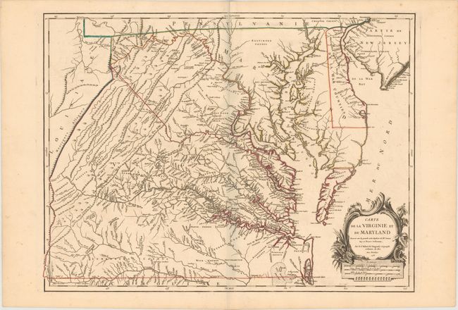
MapMaker: |
Didier Robert de Vaugondy
|
|
| |
| |
Subject: |
Colonial Mid-Atlantic United States, Virginia & Maryland |
|
| |
Period/Size: |
1755 / 19.1" x 25.2" (48.6 x 64.0 cm)
|
|
| |
Color: |
Colored
|
|
| |
Condition: |
(A) Fine original outline color, a sharp impression, and wide original margins. There is very faint offsetting in the image and a bit of light foxing in blank margins, still overall near fine condition. (condition help) |
|
| |
Source: |
Atlas Universel |
|
| |
References: |
cf. Cumming (SE) #281; Pedley #470; Phillips (M) p. 49; Sellers & Van Ee #1432. |
|
| |
|
|
| Sales Information |
| |
| |
Price: |
|
|
| |
| |
Offered by: |
Old World Auctions |
|
| |
Catalog: |
Auction No. 146 - Antique Maps, Charts, Atlases & Globes (9225) |
|
| |
Lot/Item #: |
164 |
|
| |
| |
Date: |
09/2013
|
|
| |
| |
|