| Item Detail |
| |
| |
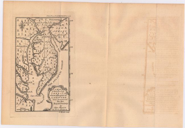
MapMaker: |
James Mynde
|
|
| |
| |
Subject: |
Colonial Mid-Atlantic United States |
|
| |
Period/Size: |
1768 / 6.6" x 3.9" (16.8 x 9.9 cm)
|
|
| |
Color: |
Black & White
|
|
| |
Condition: |
(B+) The map is issued folding with light toning and two tiny edge tears confined to the blank margin closed on verso with archival material. Loose text is clean with light toning. (condition help) |
|
| |
Source: |
The Philosophical Transactions |
|
| |
References: |
cf. Jolly #GENT-199. |
|
| |
|
|
| Sales Information |
| |
| |
Price: |
|
|
| |
| |
Offered by: |
Old World Auctions |
|
| |
Catalog: |
Auction No. 146 - Antique Maps, Charts, Atlases & Globes (9225) |
|
| |
Lot/Item #: |
165 |
|
| |
| |
Date: |
09/2013
|
|
| |
| |
|