Title:
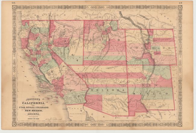
“Johnson's California, with Utah, Nevada, Colorado, New Mexico, and Arizona”
Map Maker:
Johnson & Ward
This is an early edition in this great series of m... (full text available to subscribers)
| Item Detail |
| |
| |
MapMaker: |
Johnson & Ward
|
|
| |
| |
Subject: |
Southwestern United States |
|
| |
Period/Size: |
1862 / 17.0" x 23.5" (43.2 x 59.7 cm)
|
|
| |
Color: |
Colored
|
|
| |
Condition: |
(B) There are faint damp stains at lower left and right with light toning, scattered foxing, and short centerfold separations closed on verso with archival tape. There are a few edge tears in blank margins that have been closed on verso with archival tap (condition help) |
|
| |
Source: |
Illustrated Family Atlas |
|
| |
References: |
|
|
| |
|
|
| Sales Information |
| |
| |
Price: |
|
|
| |
| |
Offered by: |
Old World Auctions |
|
| |
Catalog: |
Auction No. 146 - Antique Maps, Charts, Atlases & Globes (9225) |
|
| |
Lot/Item #: |
192 |
|
| |
| |
Date: |
09/2013
|
|
| |
| |
|
Antique Maps - Valuation and Pricing, Descriptions, Resources |
|
Home |
Information |
Search |
Register |
Contact Us |
Site Map
Americana Exchange, Inc. © 1999 - 2024 Americana Exchange, Inc.. All rights reserved.
OldMaps.com, the OldMaps.com logo and
AMPR are service marks or registered service marks of Americana Exchange, Inc..
|