| Item Detail |
| |
| |
MapMaker: |
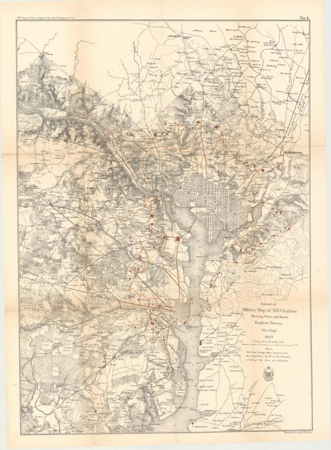
U.S. Army
|
|
| |
| |
Subject: |
Virginia & Washington D.C., Civil War |
|
| |
Period/Size: |
1866 / 23.4" x 16.6" (59.5 x 42.2 cm)
|
|
| |
Color: |
Colored
|
|
| |
Condition: |
(B+) Issued folding with light toning along the folds and a few tiny splits at fold intersections. (condition help) |
|
| |
Source: |
Report of Chief Engineer U.S.A., 39th Congress, 1st Session |
|
| |
References: |
Stephenson (CW) #686. |
|
| |
|
|
| Sales Information |
| |
| |
Price: |
|
|
| |
| |
Offered by: |
Old World Auctions |
|
| |
Catalog: |
Auction No. 146 - Antique Maps, Charts, Atlases & Globes (9225) |
|
| |
Lot/Item #: |
266 |
|
| |
| |
Date: |
09/2013
|
|
| |
| |
|