| Item Detail |
| |
| |
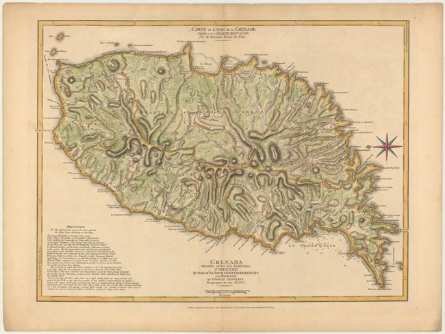
MapMaker: |
Jefferys/Sayer
|
|
| |
| |
Subject: |
Grenada |
|
| |
Period/Size: |
1775 / 18.3" x 24.3" (46.5 x 61.8 cm)
|
|
| |
Color: |
Colored
|
|
| |
Condition: |
(B+) A fine impression on heavy, watermarked paper with a hint of toning and a small, faint spot at far left. There are centerfold separations at top and bottom confined to the blank margins closed on verso with archival material. (condition help) |
|
| |
Source: |
The West Indian Atlas |
|
| |
References: |
Tooley (MCC-62) #25; Shirley (BL Atlases) M.JEF-4a #36. |
|
| |
|
|
| Sales Information |
| |
| |
Price: |
|
|
| |
| |
Offered by: |
Old World Auctions |
|
| |
Catalog: |
Auction No. 146 - Antique Maps, Charts, Atlases & Globes (9225) |
|
| |
Lot/Item #: |
318 |
|
| |
| |
Date: |
09/2013
|
|
| |
| |
|