Title:
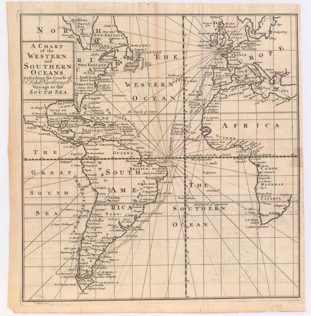
“A Chart of the Western and Southern Oceans Describing the Course of Sr. John Narbrough's Voyage to the South Sea”
Map Maker:
Tancred Robinson
Attractive chart centered on the Atlantic Ocean an... (full text available to subscribers)
| Item Detail |
| |
| |
MapMaker: |
Tancred Robinson
|
|
| |
| |
Subject: |
Atlantic Ocean |
|
| |
Period/Size: |
1711 / 10.5" x 10.0" (26.7 x 25.4 cm)
|
|
| |
Color: |
Black & White
|
|
| |
Condition: |
(B+) Issued folding, now pressed with light offsetting and minor toning. There is one very short tear that just enters map image at right that has been closed on verso with archival tape. (condition help) |
|
| |
Source: |
An Account of Several Late Voyages and Discoveries |
|
| |
References: |
|
|
| |
|
|
| Sales Information |
| |
| |
Price: |
|
|
| |
| |
Offered by: |
Old World Auctions |
|
| |
Catalog: |
Auction No. 146 - Antique Maps, Charts, Atlases & Globes (9225) |
|
| |
Lot/Item #: |
369 |
|
| |
| |
Date: |
09/2013
|
|
| |
| |
|
Antique Maps - Valuation and Pricing, Descriptions, Resources |
|
Home |
Information |
Search |
Register |
Contact Us |
Site Map
Americana Exchange, Inc. © 1999 - 2024 Americana Exchange, Inc.. All rights reserved.
OldMaps.com, the OldMaps.com logo and
AMPR are service marks or registered service marks of Americana Exchange, Inc..
|