| Item Detail |
| |
| |
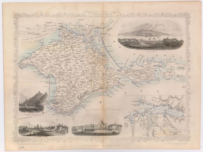
MapMaker: |
John Tallis
|
|
| |
| |
Subject: |
Crimea, Ukraine |
|
| |
Period/Size: |
1850 / 9.9" x 13.2" (25.2 x 33.6 cm)
|
|
| |
Color: |
Colored
|
|
| |
Condition: |
(B+) Some light toning along the centerfold with light soiling and one tiny pin hole in the image that is only noticeable when held up to light. (condition help) |
|
| |
Source: |
Illustrated Atlas and Modern History of the World |
|
| |
References: |
|
|
| |
|
|
| Sales Information |
| |
| |
Price: |
|
|
| |
| |
Offered by: |
Old World Auctions |
|
| |
Catalog: |
Auction No. 146 - Antique Maps, Charts, Atlases & Globes (9225) |
|
| |
Lot/Item #: |
571 |
|
| |
| |
Date: |
09/2013
|
|
| |
| |
|