Rister or Sign In to see pricing information


Title:

De Heylige en Wytvermaerde Stadt Ierusalem, Eerst Genaemt Salem

Map Maker:

Claes Janszoon Visscher

De Heylige en Wytvermaerde Stadt Ierusalem, Eerst Genaemt Salem

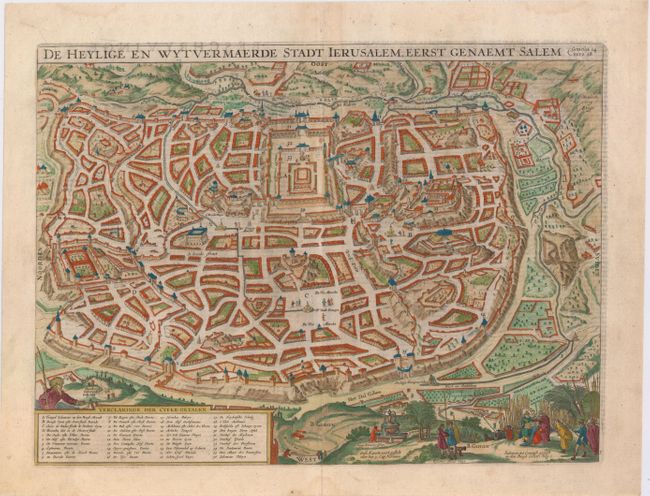
This detailed bird's-eye plan was one of the most ... (full text available to subscribers)
Item Detail
 
  MapMaker:  

Claes Janszoon Visscher


  Subject:  Jerusalem, Holy Land  
  Period/Size:  1650 / 12.0" x 16.1"  (30.5 x 40.9 cm)  
  Color:  Colored  
  Condition:  (B+) Watermarked paper with nice margins, a few small spots, and a professionally repaired centerfold separation at bottom. (condition help)  
  Source:   
  References:  Poortman & Augusteijn #87.  
 
 
Sales Information
 
  Price: 

Please register your email to view records, or sign in with email address to see records


  Offered by:  Old World Auctions  
  Catalog:  Auction No. 146 - Antique Maps, Charts, Atlases & Globes (9225)  
  Lot/Item #:  664  
 
  Date:  09/2013  


Antique Maps - Valuation and Pricing, Descriptions, Resources


Home | Information | Search | Register | Contact Us | Site Map

Americana Exchange, Inc. © 1999 - 2024 Americana Exchange, Inc.. All rights reserved. OldMaps.com, the OldMaps.com logo and
AMPR are service marks or registered service marks of Americana Exchange, Inc..