| Item Detail |
| |
| |
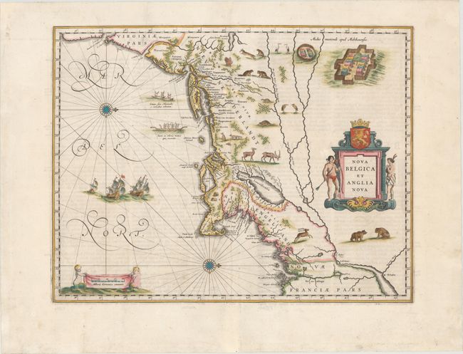
MapMaker: |
Willem Blaeu
|
|
| |
| |
Subject: |
Colonial New England & Mid-Atlantic |
|
| |
Period/Size: |
1662 / 15.2" x 19.7" (38.6 x 50.1 cm)
|
|
| |
Color: |
Colored
|
|
| |
Condition: |
(B+) A fine impression with wide, original margins, light show-through of text on verso, and a number of tiny worm holes along centerfold that have been professionally infilled with a small amount of image in facsimile. There are some small chips and tea (condition help) |
|
| |
Source: |
Atlas Maior |
|
| |
References: |
Burden #241; Goss (Blaeu) p. 164; McCorkle #635.1; Van der Krogt (Vol. II) #9310:2. |
|
| |
|
|
| Sales Information |
| |
| |
Price: |
|
|
| |
| |
Offered by: |
Old World Auctions |
|
| |
Catalog: |
Auction No. 147 - Antique Maps, Charts, Atlases & Globes (9226) |
|
| |
Lot/Item #: |
148 |
|
| |
| |
Date: |
11/2013
|
|
| |
| |
|