| Item Detail |
| |
| |
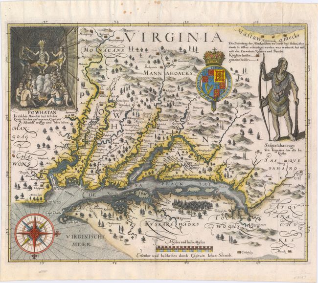
MapMaker: |
Matthaus Merian
|
|
| |
| |
Subject: |
Colonial Mid-Atlantic |
|
| |
Period/Size: |
1627 / 11.3" x 14.0" (28.7 x 35.6 cm)
|
|
| |
Color: |
Colored
|
|
| |
Condition: |
(A) A very attractive example on a clean sheet of watermarked paper with a few tiny spots of excess watercolor in the image. (condition help) |
|
| |
Source: |
Grand Voyages, Part XIII |
|
| |
References: |
Burden #219; Tooley (Amer) p. 163-4 #3, plt 71; Garratt (TMC-9) p. 9; #G39; Reinhartz, pp. 6-7. |
|
| |
|
|
| Sales Information |
| |
| |
Price: |
|
|
| |
| |
Offered by: |
Old World Auctions |
|
| |
Catalog: |
Auction No. 147 - Antique Maps, Charts, Atlases & Globes (9226) |
|
| |
Lot/Item #: |
153 |
|
| |
| |
Date: |
11/2013
|
|
| |
| |
|