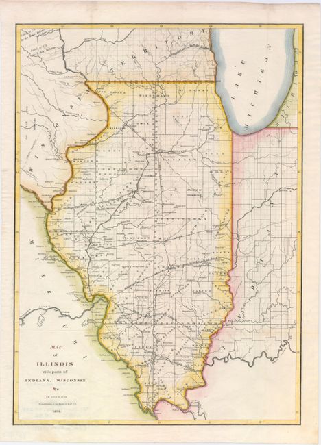
Title:
“Map of Illinois with Parts of Indiana, Wisconsin, &c.”
Map Maker:
David H. Burr
This detailed map provides information on the coun... (full text available to subscribers)
| Item Detail |
| |
| |
MapMaker: |
David H. Burr
|
|
| |
| |
Subject: |
Illinois |
|
| |
Period/Size: |
1836 / 17.5" x 12.5" (44.5 x 31.8 cm)
|
|
| |
Color: |
Colored
|
|
| |
Condition: |
(A) Clean and bright example. Issued folding and now flattened. (condition help) |
|
| |
Source: |
|
|
| |
References: |
Claussen & Friis #146. |
|
| |
|
|
| Sales Information |
| |
| |
Price: |
|
|
| |
| |
Offered by: |
Old World Auctions |
|
| |
Catalog: |
Auction No. 147 - Antique Maps, Charts, Atlases & Globes (9226) |
|
| |
Lot/Item #: |
216 |
|
| |
| |
Date: |
11/2013
|
|
| |
| |
|
Antique Maps - Valuation and Pricing, Descriptions, Resources |
|
Home |
Information |
Search |
Register |
Contact Us |
Site Map
Americana Exchange, Inc. © 1999 - 2024 Americana Exchange, Inc.. All rights reserved.
OldMaps.com, the OldMaps.com logo and
AMPR are service marks or registered service marks of Americana Exchange, Inc..
|