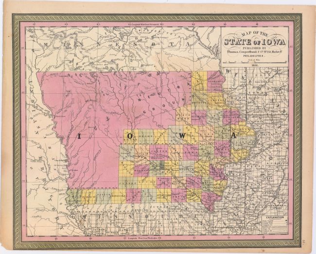
Title:
“Map of the State of Iowa”
Map Maker:
Thomas, Cowperthwait & Co.
A fine map of the state showing the extent of sett... (full text available to subscribers)
| Item Detail |
| |
| |
MapMaker: |
Thomas, Cowperthwait & Co.
|
|
| |
| |
Subject: |
Iowa |
|
| |
Period/Size: |
1851 / 12.9" x 15.8" (32.8 x 40.2 cm)
|
|
| |
Color: |
Colored
|
|
| |
Condition: |
(B+) Original color with a couple of minor spots in the image and two edge tears that just enter the map border at bottom and have been closed on verso with archival tape. Narrow bottom margin as issued. (condition help) |
|
| |
Source: |
|
|
| |
References: |
|
|
| |
|
|
| Sales Information |
| |
| |
Price: |
|
|
| |
| |
Offered by: |
Old World Auctions |
|
| |
Catalog: |
Auction No. 147 - Antique Maps, Charts, Atlases & Globes (9226) |
|
| |
Lot/Item #: |
220 |
|
| |
| |
Date: |
11/2013
|
|
| |
| |
|
Antique Maps - Valuation and Pricing, Descriptions, Resources |
|
Home |
Information |
Search |
Register |
Contact Us |
Site Map
Americana Exchange, Inc. © 1999 - 2024 Americana Exchange, Inc.. All rights reserved.
OldMaps.com, the OldMaps.com logo and
AMPR are service marks or registered service marks of Americana Exchange, Inc..
|