Title:
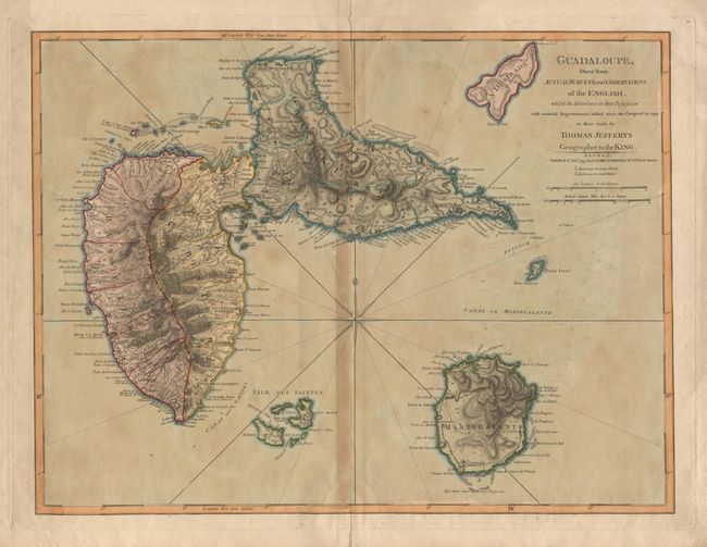
“Guadeloupe, Done from Actual Survey and Observations of the English, whilst the Island was in their Possession with material Improvements added since the Conquest in 1794”
Map Maker:
Thomas Jefferys
A detailed map of the island issued during the rev... (full text available to subscribers)
| Item Detail |
| |
| |
MapMaker: |
Thomas Jefferys
|
|
| |
| |
Subject: |
Guadeloupe |
|
| |
Period/Size: |
1795 / 18.2" x 24.2" (46.3 x 61.5 cm)
|
|
| |
Color: |
Colored
|
|
| |
Condition: |
(B) Dark toning on centerfold and slight oxidation of original color, else good. (condition help) |
|
| |
Source: |
The West-India Atlas or, A Compendious Description of the West-Indies |
|
| |
References: |
Phillips (A) #2703-51. |
|
| |
|
|
| Sales Information |
| |
| |
Price: |
|
|
| |
| |
Offered by: |
Old World Auctions |
|
| |
Catalog: |
Auction No. 96 - Antique Maps, Charts, Atlases & Globes (168) |
|
| |
Lot/Item #: |
236 |
|
| |
| |
Date: |
09/2001
|
|
| |
| |
|
Antique Maps - Valuation and Pricing, Descriptions, Resources |
|
Home |
Information |
Search |
Register |
Contact Us |
Site Map
Americana Exchange, Inc. © 1999 - 2024 Americana Exchange, Inc.. All rights reserved.
OldMaps.com, the OldMaps.com logo and
AMPR are service marks or registered service marks of Americana Exchange, Inc..
|