| Item Detail |
| |
| |
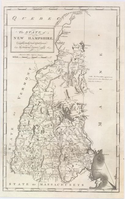
MapMaker: |
Lewis/Carey
|
|
| |
| |
Subject: |
New Hampshire |
|
| |
Period/Size: |
1794 / 17.9" x 11.3" (45.5 x 28.7 cm)
|
|
| |
Color: |
Black & White
|
|
| |
Condition: |
(B) There are extraneous creases and some short tears and tiny holes that have been closed on verso with archival materials. (condition help) |
|
| |
Source: |
Carey's American Atlas |
|
| |
References: |
Cobb (NH) #68; Wheat & Brun #185; Phillips (A) #1362-3. |
|
| |
|
|
| Sales Information |
| |
| |
Price: |
|
|
| |
| |
Offered by: |
Old World Auctions |
|
| |
Catalog: |
Auction No. 147 - Antique Maps, Charts, Atlases & Globes (9226) |
|
| |
Lot/Item #: |
228 |
|
| |
| |
Date: |
11/2013
|
|
| |
| |
|