Title:
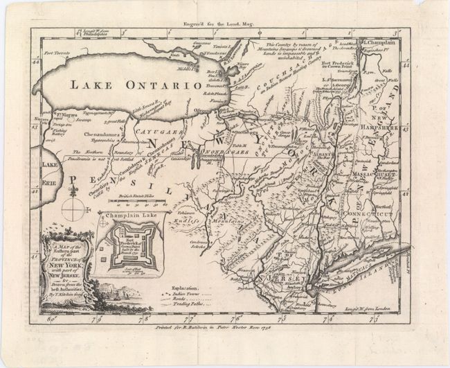
“A Map of the Eastern Part of the Province of New York; with Part of New Jersey, &c. Drawn from the Best Authorities”
Map Maker:
Thomas Kitchin
Interesting, small map depicting the main theater ... (full text available to subscribers)
| Item Detail |
| |
| |
MapMaker: |
Thomas Kitchin
|
|
| |
| |
Subject: |
Colonial New York |
|
| |
Period/Size: |
1756 / 6.7" x 8.6" (17.1 x 21.9 cm)
|
|
| |
Color: |
Black & White
|
|
| |
Condition: |
(A) A sharp impression on watermarked paper, issued folding, now pressed flat, with fold separations that have been closed on verso with Japanese tissue. There is faint offsetting from an opposing page of text on the far left. (condition help) |
|
| |
Source: |
London Magazine |
|
| |
References: |
Jolly #LOND-109; Sellers & Van Ee #1038. |
|
| |
|
|
| Sales Information |
| |
| |
Price: |
|
|
| |
| |
Offered by: |
Old World Auctions |
|
| |
Catalog: |
Auction No. 147 - Antique Maps, Charts, Atlases & Globes (9226) |
|
| |
Lot/Item #: |
229 |
|
| |
| |
Date: |
11/2013
|
|
| |
| |
|
Antique Maps - Valuation and Pricing, Descriptions, Resources |
|
Home |
Information |
Search |
Register |
Contact Us |
Site Map
Americana Exchange, Inc. © 1999 - 2024 Americana Exchange, Inc.. All rights reserved.
OldMaps.com, the OldMaps.com logo and
AMPR are service marks or registered service marks of Americana Exchange, Inc..
|