Title:
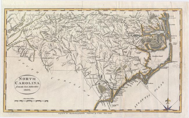
“North Carolina from the Best Authorities”
Map Maker:
Esther Prentiss. Lowe
This is an early map of the state of North Carolin... (full text available to subscribers)
| Item Detail |
| |
| |
MapMaker: |
Esther Prentiss. Lowe
|
|
| |
| |
Subject: |
North Carolina |
|
| |
Period/Size: |
1800 / 7.4" x 12.7" (18.8 x 32.3 cm)
|
|
| |
Color: |
Colored
|
|
| |
Condition: |
(B+) Issued folding with a 2" split near the fold at bottom right that has been closed with archival tape on verso and some extraneous creases. (condition help) |
|
| |
Source: |
The New Encyclopaedia |
|
| |
References: |
|
|
| |
|
|
| Sales Information |
| |
| |
Price: |
|
|
| |
| |
Offered by: |
Old World Auctions |
|
| |
Catalog: |
Auction No. 147 - Antique Maps, Charts, Atlases & Globes (9226) |
|
| |
Lot/Item #: |
235 |
|
| |
| |
Date: |
11/2013
|
|
| |
| |
|
Antique Maps - Valuation and Pricing, Descriptions, Resources |
|
Home |
Information |
Search |
Register |
Contact Us |
Site Map
Americana Exchange, Inc. © 1999 - 2024 Americana Exchange, Inc.. All rights reserved.
OldMaps.com, the OldMaps.com logo and
AMPR are service marks or registered service marks of Americana Exchange, Inc..
|