| Item Detail |
| |
| |
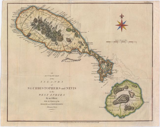
MapMaker: |
John Cary
|
|
| |
| |
Subject: |
St. Kitts & Nevis |
|
| |
Period/Size: |
1782 / 12.3" x 15.0" (31.3 x 38.1 cm)
|
|
| |
Color: |
Colored
|
|
| |
Condition: |
(B+) Issued folding, now pressed on watermarked paper. A binding trim at right that enters map border less than 1/2" at bottom has been professionally replaced, with part of neatline and the "t" in "Negro Point" expertly replaced in facsimile. An adjace (condition help) |
|
| |
Source: |
European Magazine |
|
| |
References: |
Jolly #EUR-1. |
|
| |
|
|
| Sales Information |
| |
| |
Price: |
|
|
| |
| |
Offered by: |
Old World Auctions |
|
| |
Catalog: |
Auction No. 147 - Antique Maps, Charts, Atlases & Globes (9226) |
|
| |
Lot/Item #: |
303 |
|
| |
| |
Date: |
11/2013
|
|
| |
| |
|