Title:
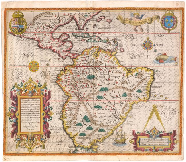
“Americae Pars Magis Cognita”
Map Maker:
Theodore de Bry
Focusing on the Spanish possessions in the America... (full text available to subscribers)
| Item Detail |
| |
| |
MapMaker: |
Theodore de Bry
|
|
| |
| |
Subject: |
South America |
|
| |
Period/Size: |
1592 / 14.3" x 17.4" (36.4 x 44.2 cm)
|
|
| |
Color: |
Colored
|
|
| |
Condition: |
(B) Issued folding with a 3/8" hole at the fold intersection at bottom center and a few adjacent tiny tears that have all been professionally repaired. There are several printer's creases at bottom and two spots just below the equator -- in Brazil and of (condition help) |
|
| |
Source: |
Grand Voyages |
|
| |
References: |
Burden #80; Garratt (TMC-9) #G-3. |
|
| |
|
|
| Sales Information |
| |
| |
Price: |
|
|
| |
| |
Offered by: |
Old World Auctions |
|
| |
Catalog: |
Auction No. 147 - Antique Maps, Charts, Atlases & Globes (9226) |
|
| |
Lot/Item #: |
317 |
|
| |
| |
Date: |
11/2013
|
|
| |
| |
|
Antique Maps - Valuation and Pricing, Descriptions, Resources |
|
Home |
Information |
Search |
Register |
Contact Us |
Site Map
Americana Exchange, Inc. © 1999 - 2024 Americana Exchange, Inc.. All rights reserved.
OldMaps.com, the OldMaps.com logo and
AMPR are service marks or registered service marks of Americana Exchange, Inc..
|