Title:
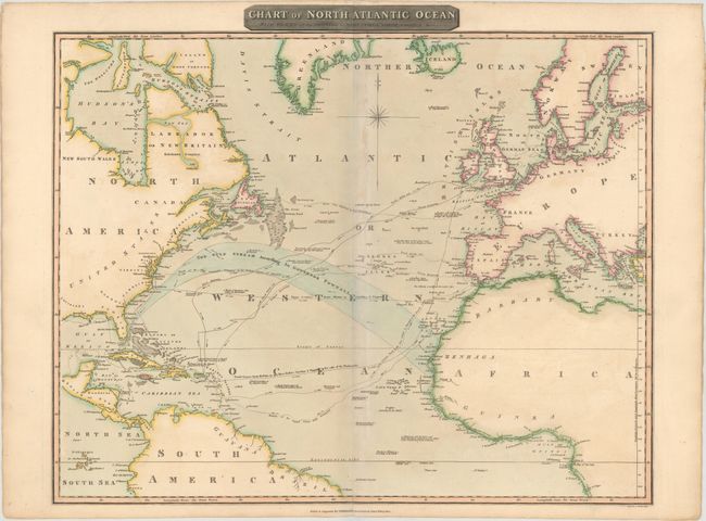
“Chart of North Atlantic Ocean with Tracks of the Shipping to West Indies, North America &cc.”
Map Maker:
John Thomson [& Co.]
This large chart focuses on the important shipping... (full text available to subscribers)
| Item Detail |
| |
| |
MapMaker: |
John Thomson [& Co.]
|
|
| |
| |
Subject: |
Atlantic Ocean |
|
| |
Period/Size: |
1815 / 20.7" x 24.7" (52.6 x 62.8 cm)
|
|
| |
Color: |
Colored
|
|
| |
Condition: |
(B+) A few small abrasions along the centerfold that have been archivally repaired, minor toning, and faint offsetting. (condition help) |
|
| |
Source: |
New General Atlas |
|
| |
References: |
|
|
| |
|
|
| Sales Information |
| |
| |
Price: |
|
|
| |
| |
Offered by: |
Old World Auctions |
|
| |
Catalog: |
Auction No. 147 - Antique Maps, Charts, Atlases & Globes (9226) |
|
| |
Lot/Item #: |
362 |
|
| |
| |
Date: |
11/2013
|
|
| |
| |
|
Antique Maps - Valuation and Pricing, Descriptions, Resources |
|
Home |
Information |
Search |
Register |
Contact Us |
Site Map
Americana Exchange, Inc. © 1999 - 2024 Americana Exchange, Inc.. All rights reserved.
OldMaps.com, the OldMaps.com logo and
AMPR are service marks or registered service marks of Americana Exchange, Inc..
|