| Item Detail |
| |
| |
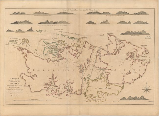
MapMaker: |
Carington Bowles
|
|
| |
| |
Subject: |
Falkland Islands |
|
| |
Period/Size: |
1770 / 17.7" x 27.4" (45.0 x 69.6 cm)
|
|
| |
Color: |
Colored
|
|
| |
Condition: |
(B) Original color on watermarked paper with light toning and offsetting, some soiling, and an extraneous crease running adjacent to centerfold. (condition help) |
|
| |
Source: |
|
|
| |
References: |
Fordham (MCC-11) #7. |
|
| |
|
|
| Sales Information |
| |
| |
Price: |
|
|
| |
| |
Offered by: |
Old World Auctions |
|
| |
Catalog: |
Auction No. 147 - Antique Maps, Charts, Atlases & Globes (9226) |
|
| |
Lot/Item #: |
369 |
|
| |
| |
Date: |
11/2013
|
|
| |
| |
|