Title:
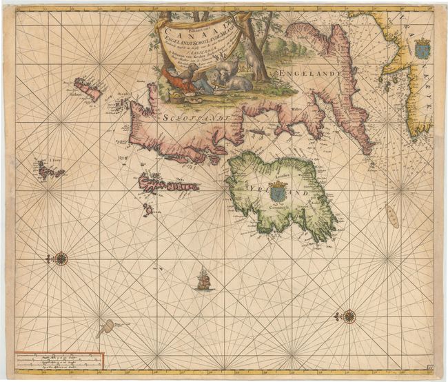
“Paskaart van't Canaal Engelandt Schotlandt en Yrland. Naaukeurig. Opgestelt en Dienstig Voor die Achter Yrland Omkomen…”
Map Maker:
Johannes van Keulen
This is the second of Johannes van Keulen's sea ch... (full text available to subscribers)
| Item Detail |
| |
| |
MapMaker: |
Johannes van Keulen
|
|
| |
| |
Subject: |
Britain |
|
| |
Period/Size: |
1698 / 20.0" x 23.0" (50.8 x 58.5 cm)
|
|
| |
Color: |
Colored
|
|
| |
Condition: |
(B) A nice impression on double-thick paper with light soiling and a few short tears in blank margins. There is a small professionally repaired hole in an unengraved area in Scotland, and a tiny worm hole adjacent to the Island of Man that has been close (condition help) |
|
| |
Source: |
|
|
| |
References: |
Shirley (BI to 1750) Van Keulen 2. |
|
| |
|
|
| Sales Information |
| |
| |
Price: |
|
|
| |
| |
Offered by: |
Old World Auctions |
|
| |
Catalog: |
Auction No. 147 - Antique Maps, Charts, Atlases & Globes (9226) |
|
| |
Lot/Item #: |
395 |
|
| |
| |
Date: |
11/2013
|
|
| |
| |
|
Antique Maps - Valuation and Pricing, Descriptions, Resources |
|
Home |
Information |
Search |
Register |
Contact Us |
Site Map
Americana Exchange, Inc. © 1999 - 2024 Americana Exchange, Inc.. All rights reserved.
OldMaps.com, the OldMaps.com logo and
AMPR are service marks or registered service marks of Americana Exchange, Inc..
|