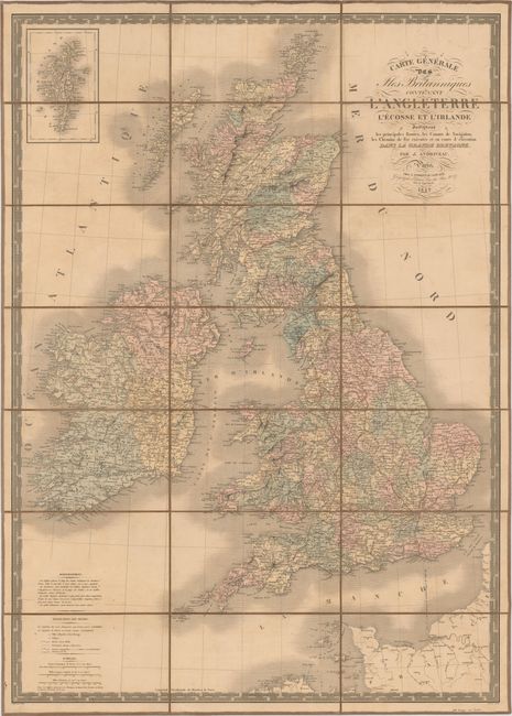
Title:
“Carte Generale des Iles Britanniques Contenant l'Angleterre l'Ecosse et l'Irlande”
Map Maker:
J. Andriveau-Goujon
A large, detailed 19th century map of the British ... (full text available to subscribers)
| Item Detail |
| |
| |
MapMaker: |
J. Andriveau-Goujon
|
|
| |
| |
Subject: |
Britain |
|
| |
Period/Size: |
1842 / 34.1" x 24.3" (86.7 x 61.8 cm)
|
|
| |
Color: |
Colored
|
|
| |
Condition: |
(B) Moderate toning and soiling with a few small separations in linen at fold intersections. (condition help) |
|
| |
Source: |
|
|
| |
References: |
|
|
| |
|
|
| Sales Information |
| |
| |
Price: |
|
|
| |
| |
Offered by: |
Old World Auctions |
|
| |
Catalog: |
Auction No. 147 - Antique Maps, Charts, Atlases & Globes (9226) |
|
| |
Lot/Item #: |
397 |
|
| |
| |
Date: |
11/2013
|
|
| |
| |
|
Antique Maps - Valuation and Pricing, Descriptions, Resources |
|
Home |
Information |
Search |
Register |
Contact Us |
Site Map
Americana Exchange, Inc. © 1999 - 2024 Americana Exchange, Inc.. All rights reserved.
OldMaps.com, the OldMaps.com logo and
AMPR are service marks or registered service marks of Americana Exchange, Inc..
|