Title:
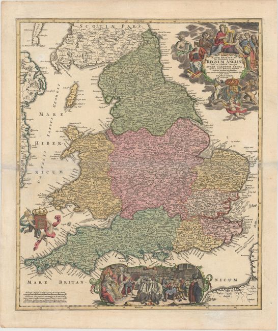
“Magnae Britanniae Pars Meridionalis, in qua Regnum Angliae tam in Septem Antiqua Anglo-Saxonum Regna…”
Map Maker:
Johann Baptist Homann
This handsome map is based upon Visscher's map of ... (full text available to subscribers)
| Item Detail |
| |
| |
MapMaker: |
Johann Baptist Homann
|
|
| |
| |
Subject: |
England & Wales |
|
| |
Period/Size: |
1720 / 22.4" x 19.1" (56.9 x 48.6 cm)
|
|
| |
Color: |
Colored
|
|
| |
Condition: |
(B+) Original color in map with later coloring in decorative elements. There is light soiling, a printer's crease adjacent to centerfold, and several faint damp stains at very bottom of map. (condition help) |
|
| |
Source: |
Atlas Novus |
|
| |
References: |
Shirley (BI to 1750) Homann 3. |
|
| |
|
|
| Sales Information |
| |
| |
Price: |
|
|
| |
| |
Offered by: |
Old World Auctions |
|
| |
Catalog: |
Auction No. 147 - Antique Maps, Charts, Atlases & Globes (9226) |
|
| |
Lot/Item #: |
407 |
|
| |
| |
Date: |
11/2013
|
|
| |
| |
|
Antique Maps - Valuation and Pricing, Descriptions, Resources |
|
Home |
Information |
Search |
Register |
Contact Us |
Site Map
Americana Exchange, Inc. © 1999 - 2024 Americana Exchange, Inc.. All rights reserved.
OldMaps.com, the OldMaps.com logo and
AMPR are service marks or registered service marks of Americana Exchange, Inc..
|