Title:
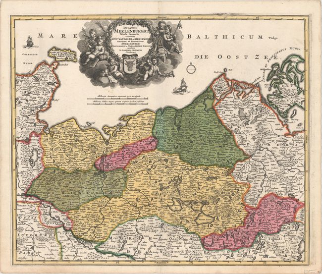
“Ducatus Meklenburgici Tabula Generalis Continens Duc. Vandaliae et Meklenburg Comitatum et Episcopatum Swerinensem Rostochiense et Stargardiense Dominium”
Map Maker:
Johann Baptist Homann
Bold, decorative map covers the region from Holste... (full text available to subscribers)
| Item Detail |
| |
| |
MapMaker: |
Johann Baptist Homann
|
|
| |
| |
Subject: |
Germany |
|
| |
Period/Size: |
1720 / 19.3" x 22.8" (49.1 x 58.0 cm)
|
|
| |
Color: |
Colored
|
|
| |
Condition: |
(A) Bright color and a crisp impression on a clean sheet with a centerfold separation just entering the neatline at bottom that has been closed with archival tape on verso. (condition help) |
|
| |
Source: |
|
|
| |
References: |
|
|
| |
|
|
| Sales Information |
| |
| |
Price: |
|
|
| |
| |
Offered by: |
Old World Auctions |
|
| |
Catalog: |
Auction No. 147 - Antique Maps, Charts, Atlases & Globes (9226) |
|
| |
Lot/Item #: |
464 |
|
| |
| |
Date: |
11/2013
|
|
| |
| |
|
Antique Maps - Valuation and Pricing, Descriptions, Resources |
|
Home |
Information |
Search |
Register |
Contact Us |
Site Map
Americana Exchange, Inc. © 1999 - 2024 Americana Exchange, Inc.. All rights reserved.
OldMaps.com, the OldMaps.com logo and
AMPR are service marks or registered service marks of Americana Exchange, Inc..
|