| Item Detail |
| |
| |
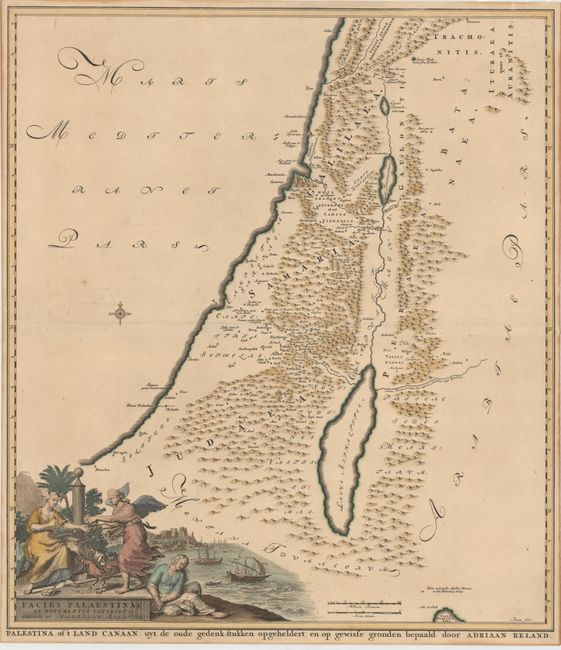
MapMaker: |
Adrien Reland
|
|
| |
| |
Subject: |
Holy Land |
|
| |
Period/Size: |
1714 / 21.9" x 19.4" (55.7 x 49.3 cm)
|
|
| |
Color: |
Colored
|
|
| |
Condition: |
(B+) A fine impression with attractive color and light toning. Narrow margins, as issued. (condition help) |
|
| |
Source: |
Palaestina ex Monumentis Veteribus Illustrata |
|
| |
References: |
Laor #643; Nebenzahl (Holy Land) #54. |
|
| |
|
|
| Sales Information |
| |
| |
Price: |
|
|
| |
| |
Offered by: |
Old World Auctions |
|
| |
Catalog: |
Auction No. 147 - Antique Maps, Charts, Atlases & Globes (9226) |
|
| |
Lot/Item #: |
579 |
|
| |
| |
Date: |
11/2013
|
|
| |
| |
|