Title:
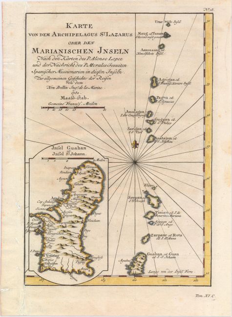
“Karte von dem Archipelagus St. Lazarus oder den Marianischen Inseln...”
Map Maker:
Jacques Nicolas Bellin
German version of this attractive chart of the Mar... (full text available to subscribers)
| Item Detail |
| |
| |
MapMaker: |
Jacques Nicolas Bellin
|
|
| |
| |
Subject: |
Mariana Islands |
|
| |
Period/Size: |
1752 / 8.9" x 6.1" (22.6 x 15.5 cm)
|
|
| |
Color: |
Colored
|
|
| |
Condition: |
(B+) A nice impression remargined at left with a sliver of space between the new margin and the neatline at bottom right. There is also minor soiling. (condition help) |
|
| |
Source: |
Prevost's Histoire Generale des Voyages |
|
| |
References: |
|
|
| |
|
|
| Sales Information |
| |
| |
Price: |
|
|
| |
| |
Offered by: |
Old World Auctions |
|
| |
Catalog: |
Auction No. 147 - Antique Maps, Charts, Atlases & Globes (9226) |
|
| |
Lot/Item #: |
691 |
|
| |
| |
Date: |
11/2013
|
|
| |
| |
|
Antique Maps - Valuation and Pricing, Descriptions, Resources |
|
Home |
Information |
Search |
Register |
Contact Us |
Site Map
Americana Exchange, Inc. © 1999 - 2024 Americana Exchange, Inc.. All rights reserved.
OldMaps.com, the OldMaps.com logo and
AMPR are service marks or registered service marks of Americana Exchange, Inc..
|