Title:
“Atlas. Narrative of the United States Exploring Expedition. During the Years 1838, 1839, 1840, 1841, 1842”
Map Maker:
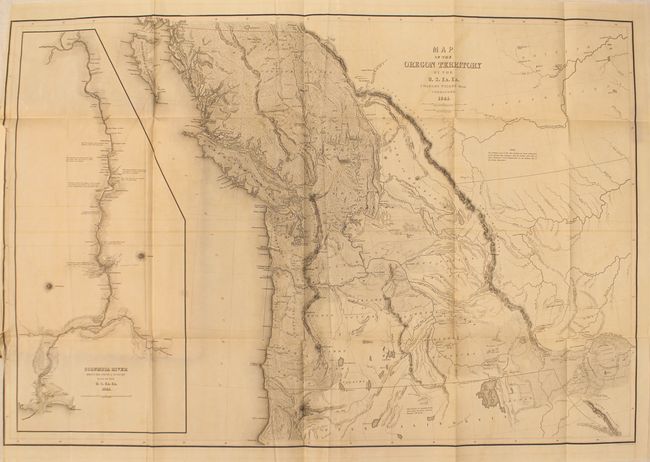
Charles Wilkes
This is the atlas volume from the very rare first ... (full text available to subscribers)
| Item Detail |
| |
| |
MapMaker: |
Charles Wilkes
|
|
| |
| |
Subject: |
Exploration and Surveys |
|
| |
Period/Size: |
1844 / 13.5" x 9.8" (34.3 x 24.9 cm)
|
|
| |
Color: |
Colored
|
|
| |
Condition: |
(B) The maps are generally good with light toning and offsetting. The colored map of the world has two moderate splits at fold junctions and a separation at bottom that enters 5.75" into the map image, while the map of Hawaii has a separation at bottom t (condition help) |
|
| |
Source: |
|
|
| |
References: |
Wheat (TMW) #457; Phillips #3245; Howes #W414. |
|
| |
|
|
| Sales Information |
| |
| |
Price: |
|
|
| |
| |
Offered by: |
Old World Auctions |
|
| |
Catalog: |
Auction No. 147 - Antique Maps, Charts, Atlases & Globes (9226) |
|
| |
Lot/Item #: |
746 |
|
| |
| |
Date: |
11/2013
|
|
| |
| |
|
Antique Maps - Valuation and Pricing, Descriptions, Resources |
|
Home |
Information |
Search |
Register |
Contact Us |
Site Map
Americana Exchange, Inc. © 1999 - 2024 Americana Exchange, Inc.. All rights reserved.
OldMaps.com, the OldMaps.com logo and
AMPR are service marks or registered service marks of Americana Exchange, Inc..
|