Title:
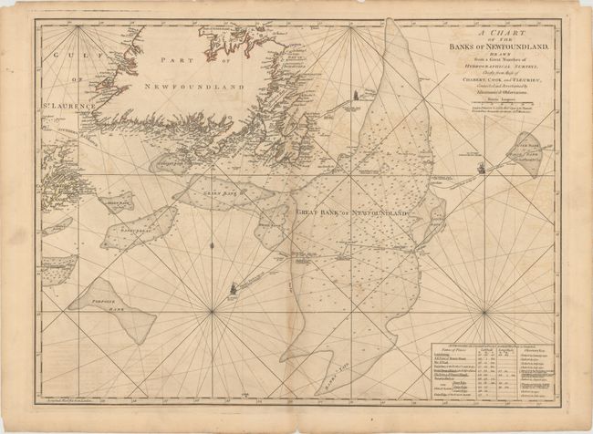
“A Chart of the Banks of Newfoundland, Drawn from a Great Number of Hydrographical Surveys, Chiefly from Those of Chabert, Cook and Fleurieu, Connected and Ascertained by Astronomical Observations”
Map Maker:
Jefferys/Sayer & Bennett
A large-scale chart of Newfoundland, part of Cape ... (full text available to subscribers)
| Item Detail |
| |
| |
MapMaker: |
Jefferys/Sayer & Bennett
|
|
| |
| |
Subject: |
Eastern Canada |
|
| |
Period/Size: |
1775 / 19.5" x 26.0" (49.6 x 66.1 cm)
|
|
| |
Color: |
Black & White
|
|
| |
Condition: |
(B) Issued on watermarked paper with light offsetting, centerfold toning, and centerfold separations at top and bottom confined to the blank margins. (condition help) |
|
| |
Source: |
|
|
| |
References: |
Phillips (A) 1165-13. |
|
| |
|
|
| Sales Information |
| |
| |
Price: |
|
|
| |
| |
Offered by: |
Old World Auctions |
|
| |
Catalog: |
Auction No. 148 - Antique Maps, Charts, Atlases & Globes (9227) |
|
| |
Lot/Item #: |
106 |
|
| |
| |
Date: |
02/2014
|
|
| |
| |
|
Antique Maps - Valuation and Pricing, Descriptions, Resources |
|
Home |
Information |
Search |
Register |
Contact Us |
Site Map
Americana Exchange, Inc. © 1999 - 2024 Americana Exchange, Inc.. All rights reserved.
OldMaps.com, the OldMaps.com logo and
AMPR are service marks or registered service marks of Americana Exchange, Inc..
|