Rister or Sign In to see pricing information


Title:

Karte von dem Laufe des Flusses St. Laurenz...

Map Maker:

Jacques Nicolas Bellin

Karte von dem Laufe des Flusses St. Laurenz...

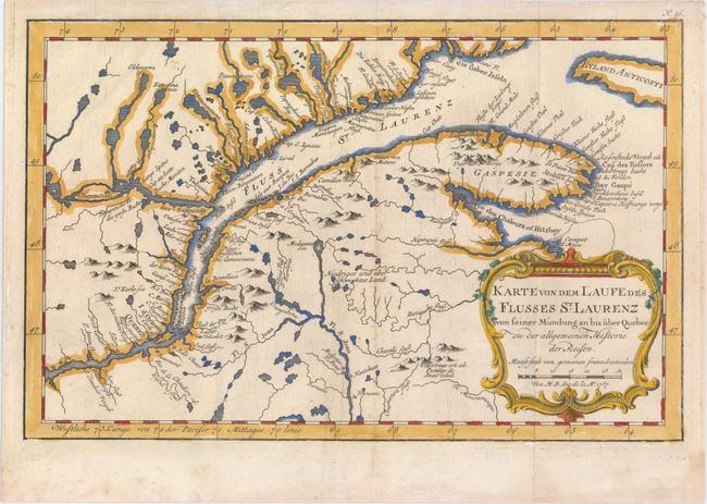
This fascinating map by Bellin details the course ... (full text available to subscribers)
Item Detail
 
  MapMaker:  

Jacques Nicolas Bellin


  Subject:  St. Lawrence River, Canada  
  Period/Size:  1757 / 7.6" x 11.9"  (19.3 x 30.3 cm)  
  Color:  Colored  
  Condition:  (A) Issued folding with a few tiny spots of foxing. (condition help)  
  Source:  Allgemeine Historie der Reisen zu Wasser und Lande  
  References:  Kershaw #636.  
 
 
Sales Information
 
  Price: 

Please register your email to view records, or sign in with email address to see records


  Offered by:  Old World Auctions  
  Catalog:  Auction No. 148 - Antique Maps, Charts, Atlases & Globes (9227)  
  Lot/Item #:  112  
 
  Date:  02/2014  


Antique Maps - Valuation and Pricing, Descriptions, Resources


Home | Information | Search | Register | Contact Us | Site Map

Americana Exchange, Inc. © 1999 - 2024 Americana Exchange, Inc.. All rights reserved. OldMaps.com, the OldMaps.com logo and
AMPR are service marks or registered service marks of Americana Exchange, Inc..