| Item Detail |
| |
| |
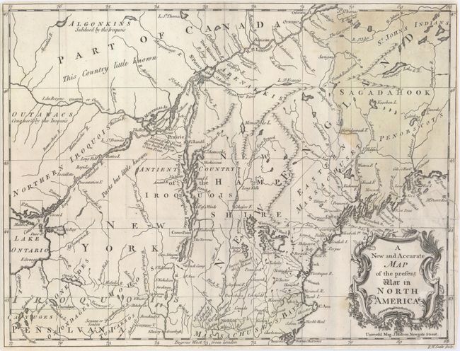
MapMaker: |
John Hinton
|
|
| |
| |
Subject: |
Colonial United States & Canada |
|
| |
Period/Size: |
1757 / 10.8" x 14.3" (27.5 x 36.4 cm)
|
|
| |
Color: |
Black & White
|
|
| |
Condition: |
(B+) Issued folding and now flattened on watermarked paper with a 1" binding tear that has been archivally repaired and a couple of minor spots. The margins have been trimmed close to the neatline. A faint wash color has been applied to the Massachusetts (condition help) |
|
| |
Source: |
Universal Magazine |
|
| |
References: |
Jolly #UNIV-58; Sellers & van Ee #79. |
|
| |
|
|
| Sales Information |
| |
| |
Price: |
|
|
| |
| |
Offered by: |
Old World Auctions |
|
| |
Catalog: |
Auction No. 148 - Antique Maps, Charts, Atlases & Globes (9227) |
|
| |
Lot/Item #: |
124 |
|
| |
| |
Date: |
02/2014
|
|
| |
| |
|