Title:
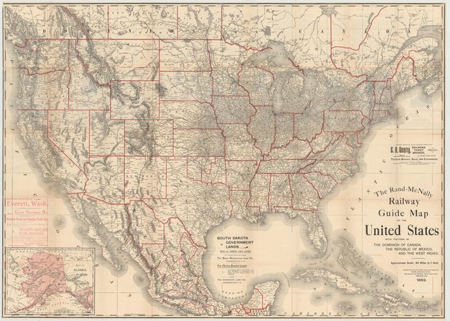
“The Rand-McNally Railway Guide Map of the United States with Portions of the Dominion of Canada, the Republic of Mexico, and the West Indies”
Map Maker:
Rand, McNally & Co.
This very large and detailed map of the United Sta... (full text available to subscribers)
| Item Detail |
| |
| |
MapMaker: |
Rand, McNally & Co.
|
|
| |
| |
Subject: |
United States, Railroads |
|
| |
Period/Size: |
1893 / 30.5" x 42.5" (77.5 x 108.0 cm)
|
|
| |
Color: |
Colored
|
|
| |
Condition: |
(B+) The map is mostly clean and bright with light toning along a couple of folds, very faint offsetting in a few spots, and short splits at fold intersections closed on verso with archival tape. (condition help) |
|
| |
Source: |
|
|
| |
References: |
|
|
| |
|
|
| Sales Information |
| |
| |
Price: |
|
|
| |
| |
Offered by: |
Old World Auctions |
|
| |
Catalog: |
Auction No. 148 - Antique Maps, Charts, Atlases & Globes (9227) |
|
| |
Lot/Item #: |
156 |
|
| |
| |
Date: |
02/2014
|
|
| |
| |
|
Antique Maps - Valuation and Pricing, Descriptions, Resources |
|
Home |
Information |
Search |
Register |
Contact Us |
Site Map
Americana Exchange, Inc. © 1999 - 2024 Americana Exchange, Inc.. All rights reserved.
OldMaps.com, the OldMaps.com logo and
AMPR are service marks or registered service marks of Americana Exchange, Inc..
|