Title:
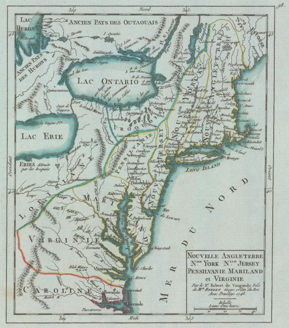
“Nouvelle Angleterre Nlle. York Nlle. Jersey Pensilvanie Mariland et Virginie”
Map Maker:
Didier Robert de Vaugondy
This small map shows the political situation in No... (full text available to subscribers)
| Item Detail |
| |
| |
MapMaker: |
Didier Robert de Vaugondy
|
|
| |
| |
Subject: |
Colonial New England & Mid-Atlantic United States |
|
| |
Period/Size: |
1748 / 7.6" x 6.4" (19.3 x 16.3 cm)
|
|
| |
Color: |
Colored
|
|
| |
Condition: |
(A+) On bluish watermarked paper with ample margins and a single unobtrusive spot. (condition help) |
|
| |
Source: |
Atlas Portatif Universel et Militaire |
|
| |
References: |
McCorkle #748.1; Pedley #468. |
|
| |
|
|
| Sales Information |
| |
| |
Price: |
|
|
| |
| |
Offered by: |
Old World Auctions |
|
| |
Catalog: |
Auction No. 148 - Antique Maps, Charts, Atlases & Globes (9227) |
|
| |
Lot/Item #: |
173 |
|
| |
| |
Date: |
02/2014
|
|
| |
| |
|
Antique Maps - Valuation and Pricing, Descriptions, Resources |
|
Home |
Information |
Search |
Register |
Contact Us |
Site Map
Americana Exchange, Inc. © 1999 - 2024 Americana Exchange, Inc.. All rights reserved.
OldMaps.com, the OldMaps.com logo and
AMPR are service marks or registered service marks of Americana Exchange, Inc..
|