| Item Detail |
| |
| |
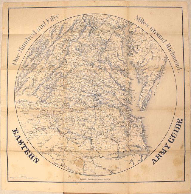
MapMaker: |
Charles Magnus [& Co.]
|
|
| |
| |
Subject: |
Mid-Atlantic United States, Virginia, Civil War |
|
| |
Period/Size: |
1863 / 22.3" x 22.4" (56.7 x 56.9 cm)
|
|
| |
Color: |
Colored
|
|
| |
Condition: |
(B) The map has scattered foxing and staining with a few tiny splits at fold intersections that have been closed on verso with archival tape. Covers have light wear and stains. (condition help) |
|
| |
Source: |
|
|
| |
References: |
|
|
| |
|
|
| Sales Information |
| |
| |
Price: |
|
|
| |
| |
Offered by: |
Old World Auctions |
|
| |
Catalog: |
Auction No. 148 - Antique Maps, Charts, Atlases & Globes (9227) |
|
| |
Lot/Item #: |
187 |
|
| |
| |
Date: |
02/2014
|
|
| |
| |
|