| Item Detail |
| |
| |
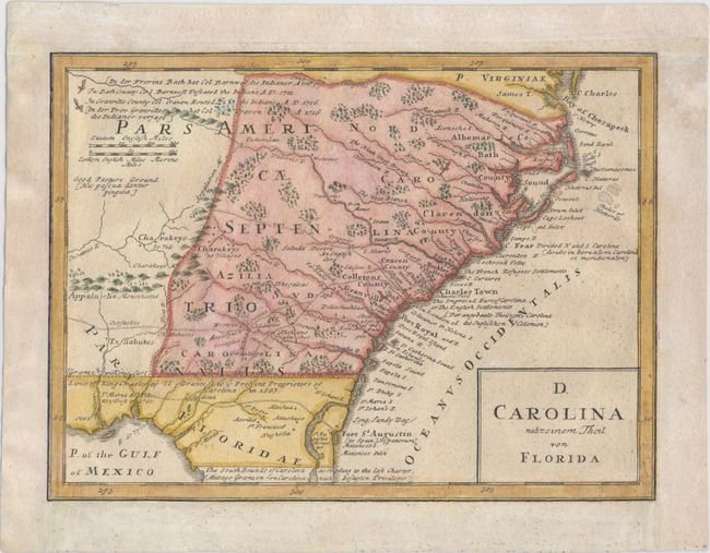
MapMaker: |
Homann Heirs
|
|
| |
| |
Subject: |
Colonia Southeast United States |
|
| |
Period/Size: |
1740 / 8.0" x 10.8" (20.4 x 27.5 cm)
|
|
| |
Color: |
Colored
|
|
| |
Condition: |
(B+) Professionally remargined with old paper at top, left, and right, with neatline at left replaced in facsimile. A nice impression with one tiny hole in border at right and an abrasion near the southern border of Carolina with a small portion of the i (condition help) |
|
| |
Source: |
Grosser Atlas |
|
| |
References: |
Cumming (SE) #233; Portinaro & Knirsch #123; Sellers & Van Ee #83. |
|
| |
|
|
| Sales Information |
| |
| |
Price: |
|
|
| |
| |
Offered by: |
Old World Auctions |
|
| |
Catalog: |
Auction No. 148 - Antique Maps, Charts, Atlases & Globes (9227) |
|
| |
Lot/Item #: |
194 |
|
| |
| |
Date: |
02/2014
|
|
| |
| |
|