Title:
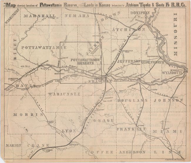
“Map Showing Location of Pottawattamie Reserve; Lands in Kansas Belonging to Atchison Topeka & Santa Fe R.R. Co.”
Map Maker:
Real Estate & Promotional Maps
This promotional brochure extols the benefits of l... (full text available to subscribers)
| Item Detail |
| |
| |
MapMaker: |
Real Estate & Promotional Maps
|
|
| |
| |
Subject: |
Eastern Kansas |
|
| |
Period/Size: |
1869 / 10.6" x 12.4" (27.0 x 31.5 cm)
|
|
| |
Color: |
Black & White
|
|
| |
Condition: |
(B+) Issued folding and now flattened with an extraneous crease at left and some light text show-through from verso. (condition help) |
|
| |
Source: |
|
|
| |
References: |
|
|
| |
|
|
| Sales Information |
| |
| |
Price: |
|
|
| |
| |
Offered by: |
Old World Auctions |
|
| |
Catalog: |
Auction No. 148 - Antique Maps, Charts, Atlases & Globes (9227) |
|
| |
Lot/Item #: |
263 |
|
| |
| |
Date: |
02/2014
|
|
| |
| |
|
Antique Maps - Valuation and Pricing, Descriptions, Resources |
|
Home |
Information |
Search |
Register |
Contact Us |
Site Map
Americana Exchange, Inc. © 1999 - 2024 Americana Exchange, Inc.. All rights reserved.
OldMaps.com, the OldMaps.com logo and
AMPR are service marks or registered service marks of Americana Exchange, Inc..
|