Title:
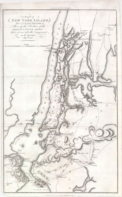
“A Plan of New York Island, Part of Long Island &c. Shewing the Position of the American & British Armies, Before, At, and After the Engagement on the Heights Aug. 27th 1776”
Map Maker:
Richard Phillips
This terrific Revolutionary War plan center... (full text available to subscribers)
| Item Detail |
| |
| |
MapMaker: |
Richard Phillips
|
|
| |
| |
Subject: |
New York, Revolutionary War |
|
| |
Period/Size: |
1806 / 16.1" x 10.1" (40.9 x 25.7 cm)
|
|
| |
Color: |
Black & White
|
|
| |
Condition: |
(A) Issued folding on watermarked paper with a hint of offsetting. There are binding holes and a small chip in the bottom blank margin. (condition help) |
|
| |
Source: |
Marshall's Life of Washington |
|
| |
References: |
|
|
| |
|
|
| Sales Information |
| |
| |
Price: |
|
|
| |
| |
Offered by: |
Old World Auctions |
|
| |
Catalog: |
Auction No. 148 - Antique Maps, Charts, Atlases & Globes (9227) |
|
| |
Lot/Item #: |
286 |
|
| |
| |
Date: |
02/2014
|
|
| |
| |
|
Antique Maps - Valuation and Pricing, Descriptions, Resources |
|
Home |
Information |
Search |
Register |
Contact Us |
Site Map
Americana Exchange, Inc. © 1999 - 2024 Americana Exchange, Inc.. All rights reserved.
OldMaps.com, the OldMaps.com logo and
AMPR are service marks or registered service marks of Americana Exchange, Inc..
|