| Item Detail |
| |
| |
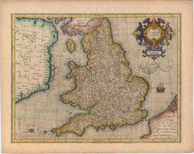
MapMaker: |
Mercator/Hondius
|
|
| |
| |
Subject: |
England & Wales |
|
| |
Period/Size: |
1595 / 13.8" x 18.1" (35.1 x 46.0 cm)
|
|
| |
Color: |
Colored
|
|
| |
Condition: |
(B+) An early impression on watermarked paper with a few small spots and a centerfold separation that enters 3" into map at top and has been repaired with old paper on verso. (condition help) |
|
| |
Source: |
Gerard Mercatoris Atlas |
|
| |
References: |
Shirley (BI to 1650) #181; Van der Krogt #5100:1A.1. |
|
| |
|
|
| Sales Information |
| |
| |
Price: |
|
|
| |
| |
Offered by: |
Old World Auctions |
|
| |
Catalog: |
Auction No. 148 - Antique Maps, Charts, Atlases & Globes (9227) |
|
| |
Lot/Item #: |
469 |
|
| |
| |
Date: |
02/2014
|
|
| |
| |
|